What is AES

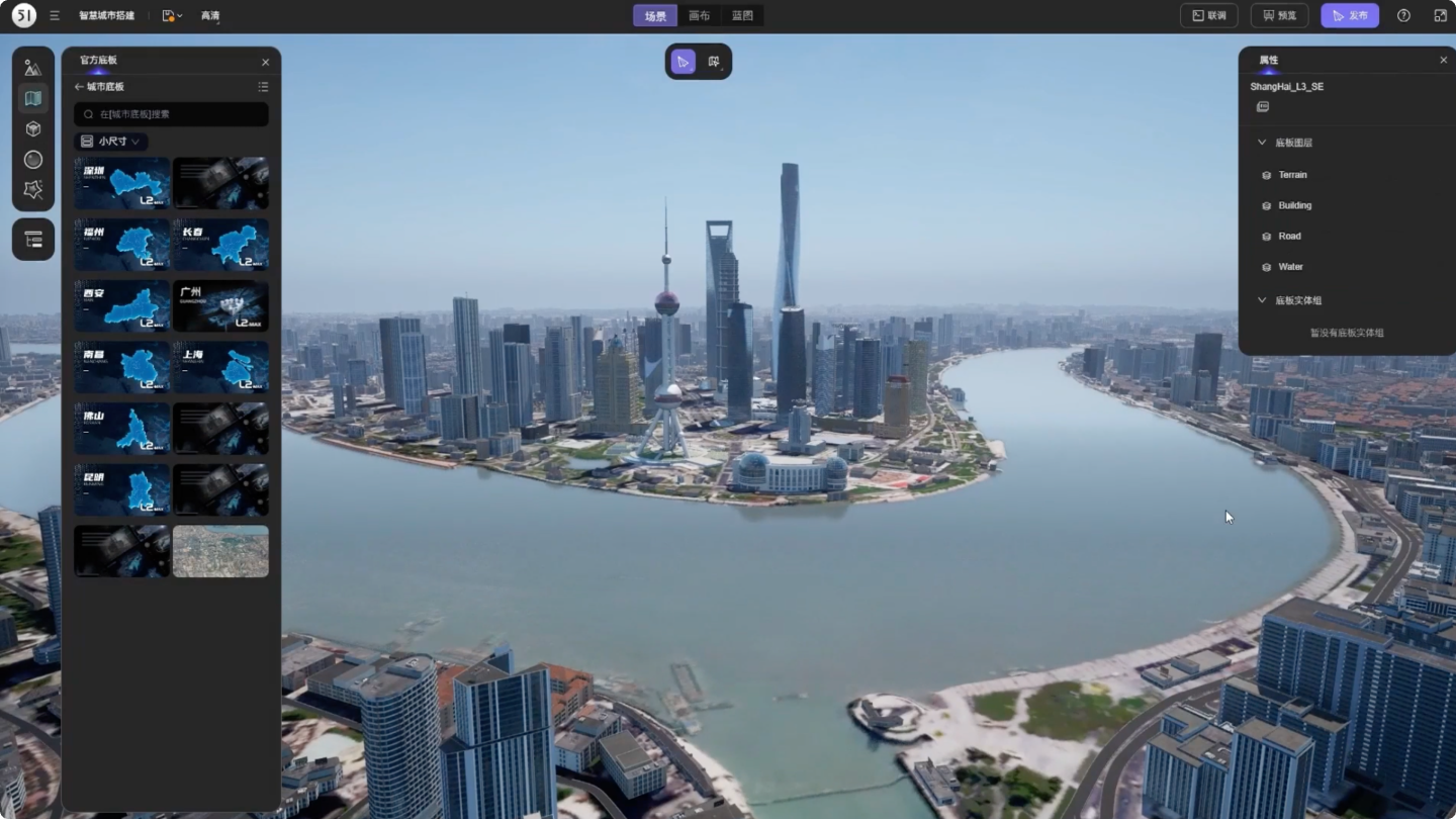
On the basis of real physical elements, 51Aes (All Element Scene) is able to faithfully simulate 3D scenes with computer graphics and artificial intelligence, to realize real-time rendering of ultra-large-scale scenes and individualized management of all elements.

How to build AESs

51Aes can quickly convert various model files describing the real physical world into virtual scenes of the digital twin world. Relying on computer graphics, computer vision, big data, cloud computing and other technologies, AES can automatically or semi-automatically construct a digital twin world.

Automated generation based on satellite orthophotos and GIS data
AI algorithms can automatically generate urban scenes from orthographic images and GIS data.
Reconstruction and generation based on OSGB data
Computer semantic recognition algorithm can automatically lightweight reconstruct based on oblique photography / lidar scanning,
Automated generation based on BIM data
Automated transformation and generation based on BIM models, while retaining the catalogs and attributes of all components and parts
Procedural generation of specific scenes
Rapid generation of specific scenes based on procedural algorithms, such as transmission stations and power grids
HD map-based generation
Generation of high-precision road scenes based on the reconstruction of point cloud models of HD map
Constructing based on massive digital asset library
Rapidly build scenes based on matching the features from massive digital asset library
Reconstruction and generation based on photo topology
3D topology reconstruction and generation model based on real photos
Rapid construction based on SaaS platform
Secondary editing of scenes based on SaaS platform

AES grading (L1-L5)

The AESs can be divided into five levels according to their reconstruction accuracies, with the models of each level varying from their data source and application scenario.

L1

city level

L1 - city level
  • Primary data:GIS
  • Recommended sight distance:500m-20km
  • Coordinate accuracy:within 5 meters (God's perspective)
  • Structural accuracy:none
  • Texture accuracy:none
  • Application scenarios:provinces and cities, large-scale scenes of tens of thousands of square kilometers

L2

regional level

L2 - regional level
  • Primary data:GIS, remote sensing data
  • Recommended sight distance:500m-20km (bird's eye view)
  • Coordinate accuracy:within 5 meters
  • Structural accuracy:none
  • Texture accuracy:satellite imagery
  • Application scenarios:the entire city, large-scale scenes of thousands of square kilometers

L3

scene level

L3 - scene level
  • Primary data:OSGB、CAD、CIM
  • Recommended sight distance:20m-5,000m (overlooking)
  • Coordinate accuracy:within 1 meter
  • Structural accuracy:main components
  • Texture accuracy:high-precision texture maps
  • Application scenarios:the whole area, medium-sized scenarios with hundreds of square kilometers

L4

component level

L4 - component level
  • Primary data:CAD, BIM, scanned models
  • Recommended sight distance:5m-2,000m (roaming)
  • Coordinate accuracy:centimeter level
  • Structural accuracy:all components
  • Texture accuracy:ultra-clear texture maps
  • Application scenarios:streets, small scenes within one square kilometer

L5

part level

L5 - part level
  • Primary data:CAD, BIM, scan, 3D printing data
  • Recommended sight distance:0.2m-100m (close-up)
  • Coordinate accuracy:centimeter level
  • Structural accuracy:detail parts
  • Texture accuracy:physical simulation
  • Application scenarios:digital twin model components dynamically driven by real-time data
L1 - city level
  • Primary data:
    GIS
  • Recommended sight distance:
    500m-20km
  • Coordinate accuracy:
    within 5 meters (God's perspective)
  • Structural accuracy:
    none
  • Texture accuracy:
    none
  • Application scenarios:
    provinces and cities, large-scale scenes of tens of thousands of square kilometers
L2 - regional level
  • Primary data:
    GIS, remote sensing data
  • Recommended sight distance:
    500m-20km (bird's eye view)
  • Coordinate accuracy:
    within 5 meters
  • Structural accuracy:
    none
  • Texture accuracy:
    satellite imagery
  • Application scenarios:
    the entire city, large-scale scenes of thousands of square kilometers
L3 - scene level
  • Primary data:
    OSGB、CAD、CIM
  • Recommended sight distance:
    20m-5,000m (overlooking)
  • Coordinate accuracy:
    within 1 meter
  • Structural accuracy:
    main components
  • Texture accuracy:
    high-precision texture maps
  • Application scenarios:
    the whole area, medium-sized scenarios with hundreds of square kilometers
L4 - component level
  • Primary data:
    CAD, BIM, scanned models
  • Recommended sight distance:
    5m-2,000m (roaming)
  • Coordinate accuracy:
    centimeter level
  • Structural accuracy:
    all components
  • Texture accuracy:
    ultra-clear texture maps
  • Application scenarios:
    streets, small scenes within one square kilometer
L5 - part level
  • Primary data:
    CAD, BIM, scan, 3D printing data
  • Recommended sight distance:
    0.2m-100m (close-up)
  • Coordinate accuracy:
    centimeter level
  • Structural accuracy:
    detail parts
  • Texture accuracy:
    physical simulation
  • Application scenarios:
    digital twin model components dynamically driven by real-time data

AES applications

51WORLD divides the applications of AES into five stages: V1 visualizing, V2 data fusing, V3 data driving, V4 simulating, and V5 intelligent decision-making. After years of technical trials and practical applications, 51WORLD has successfully implemented cases in each stage according to different requirements.

V1

visualizing

V1 - visualizing
  • Definition:it can visualize all elements in the scene in high-quality 3D through real-time rendering.
  • Value:to restore the physical world and to immerse in a digital world in every detail
  • Cases:digital sandbox, metaverse conference

V2

data fusing

V2 - data fusing
  • Definition:it can converge and present a variety of data in a unified spatio-temporal model.
  • Value:all elements are linked to operational data, which makes scene management simple and efficient
  • Cases:city/park IOC management cockpit

V3

data driving

V3 - data driving
  • Definition:data driving turns the static into the dynamic, which can keep the virtual world in sync with the real one.
  • Value:real-time data drive simulation, to achieve “what you see is what you get” for all elements.
  • Cases:intelligent transportation V2X, analysis of skiing for athletes

V4

simulating

V4 - simulating
  • Definition:algorithms drive simulation
  • Value:it can predict the changing tendencies, to offer suggestion for the real-world situation
  • Cases:operation platform for smart terminal, smart subway platform

V5

smart decision-making

V5 - smart decision-making
  • Definition:it can train AI for intelligent decision-making based on the simulated environment and massive case base
  • Value:AI computing intelligence enables the independent and quick decision for real situation
  • Cases:autonomous driving simulation platform
V1 - visualizing
  • Definition:
    it can visualize all elements in the scene in high-quality 3D through real-time rendering.
  • Value:
    to restore the physical world and to immerse in a digital world in every detail
  • Cases:
    digital sandbox, metaverse conference
V2 - data fusing
  • Definition:
    it can converge and present a variety of data in a unified spatio-temporal model.
  • Value:
    all elements are linked to operational data, which makes scene management simple and efficient
  • Cases:
    city/park IOC management cockpit
V3 - data driving
  • Definition:
    data driving turns the static into the dynamic, which can keep the virtual world in sync with the real one.
  • Value:
    real-time data drive simulation, to achieve “what you see is what you get” for all elements.
  • Cases:
    intelligent transportation V2X, analysis of skiing for athletes
V4 - simulating
  • Definition:
    algorithms drive simulation
  • Value:
    it can predict the changing tendencies, to offer suggestion for the real-world situation
  • Cases:
    operation platform for smart terminal, smart subway platform
V5 - smart decision-making
  • Definition:
    it can train AI for intelligent decision-making based on the simulated environment and massive case base
  • Value:
    AI computing intelligence enables the independent and quick decision for real situation
  • Cases:
    autonomous driving simulation platform